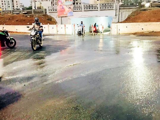
The Pune district administration declared 21 flood prone areas in Pune city and Pimpri-Chinchwad Municipal Corporation (PCMC) limits most of which are located in the PMC jurisdiction; however, the civic body has claimed that the affected parts and affected people have been reduced as it has taken precaution to construct a retaining wall and anti-encroachment drive along the river to avoid flooding during monsoon.
Under the Mula-Mutha valley, there are four dams-Temghar, Varasgaon, Panshet and Khadakwasla which supply water to Pune city and some rural parts of the Pune district. The total storage capacity of four dams is 29.15 Thousand Million Cubic feet (TMC).
The water release from these dams flows through the Pune city and merges with Bhima at Rahu about 66 kilometres from Pune city. Temghar dam has a water release capacity of 12,120 cusecs and Varasgaon and Panshet can release 52,698 cusecs and 42,036 cusecs respectively. Temghar, Varasgaon and Panshet- all three dams release water to Khadakwasla dam and therefore, Khadakwasla can release maximum 98,766 cusec water which creates flood line situation in Pune city. There are nine flood prone areas like Hingne Khurd, Vitthalwadi, Erandwane (Pulachi vadi), Shivajinagar ( Patil estate), Yerawada ( Shantinagar, Indiranagar), Sangamwadi, Aundh, Baner.
Rajesh Deshmukh, Pune district collector said, “Under the Pune district disaster management plan, we have made preparations to tackle the flood like situation in the monsoon season. We have identified 21 major flood prone spots in the PMC and PCMC area. We have given instructions to concerned officials to prepare as mentioned the duties and responsibilities in the disaster plan.”
In 2007 and 2009, the city had faced a flood situation due to excess rainfall in the PMC and adjacent part of Pune city. Considering the history of floods, PMC Disaster Management Cell (DMC) and flood control department had spotted flood prone areas within the last few years of flood situations in the city.
Mula and Mutha rivers flow through the city, the Khadakwasla irrigation division releases water when there is heavy rainfall in catchment areas of dams which affects riverside areas.
In 2015, PMC identified a total 38 flood prone areas in Pune municipal limits which included Manjari (budharuk) and Mundhwa (Keshavnagar) which are tail parts of the city areas as they had experienced flood situations.
Based on the last five-year experience and displacement of people in flood areas, there are only a few major areas where there is more risk as compared to the 2007-2009 flood.
Ganesh Sonune, head of PMC disaster management cell said, “The PMC’s disaster plan has integrated with Pune district disaster management plan. Due to information and technology (IT) service, we are getting information in advance. Therefore, we are getting more time to take precautionary measurements as early as possible.”
“As per Pune city disaster plan 2015, we had mentioned to shift around 3,000 people from low line areas along Mula-Mutha riverside. The number has come down to 300 to 500. We constructed retaining walls and removed hurdles, encroachments in most of the areas such as Pulachi wadi, Kamgar Putala near Shivajinagar, Sangamwadi and Yerawada areas reduced displacement and reduced risk of life of people. Therefore, the number of flood prone areas has also reduced, and it has come down in few numbers,” he added.
(With inputs fom agencies)